When Trimble first introduced the Vantage Dealer concept, a core tenet was to create a distribution network that required the Distributor to provide site-wide solutions that integrate Hardware, Software and Specialty Services.
Providing Specialty Services has been an integral part of our business since we started in 1980. In fact, my first introduction to the Spectra Physics Laserplane systems at the time was due to my involvement in designing fields for flood irrigation and the hardware was useless without the field design.
Today we continue to offer our customers an array of high-quality specialty services that include:
Field Surveys / Mapping - We utilise a range of data collection tools including the latest survey equipment, vehicle-mounted RTK GPS, and Unmanned Aerial Vehicles (UAVs), depending on clients’ requirements. Typical projects include:
- Collection of topographic data for Landform Design
- Layout of channels, drains, recycle pits, roads, laneways and farm reticulation projects
- Establishing a single GNSS Base Station or a network
- Generating and transferring AB lines
UAV Imagery - We have a fleet of UAVs and a qualified team to operate them. We have a wide selection of cameras and sensors available for collecting data:
- Topographic Survey
- Stress Maps
- Yield Potential
- Photosynthetic Activity
- Weed Maps
- Population Maps
Landform Design – Our Landform design services deliver the optimum levelling solution for every unique project, developed through collaboration with the farmer, their trusted advisors and contractors. Some designs are suitable for both Laser-based levelling technology and GPS-based solutions, while other designs require 3D Capable GPS solutions, like Trimble’s Field Level II or Trimble’s AG GCS900 system.
Yield Monitor Processing - We provide Yield Monitoring data processing services to Farmers and Harvesting Contractors. This includes cleaning the data, calibrating the data and producing high quality yield maps. The deliverables also include a Yield shape file, providing the customer with a fully geo-referenced electronic Yield map for use in any remedial action.
Prescription Generation - Working with the farmer and their agronomist, we produce prescriptions to apply inputs using Variable Rate Application technology. This ensures the correct dose of the input is delivered precisely to every square metre of the field using Trimble’s Field IQ application technology. The Variable Rate Application method maximises the effectiveness of the input while minimising the usage. This results in both increased yield as well as a reduction in the cost of production.
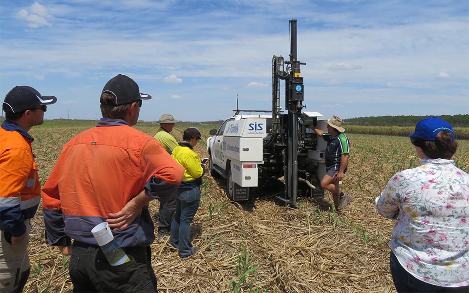
Soil Information System (SIS) – Soil Information System (SIS) is an industry-leading soil map solution that uses advanced sensors, intelligent targeting and geo-processing algorithms to produce accurate soil and topographic information in high resolution. This detailed soil map becomes a platform to make critical farm management decisions about irrigation, drainage, fertility, VRA and more.
Our goal to provide these services has remained the same - To be a grower’s “one-stop-shop” for integrating precision ag and agronomic data across the entire farm. We can provide the information to farmers, contractors and their agronomist, so decisions can be made with the combined knowledge of their farm.
Please contact your local branch to find out how we can help.